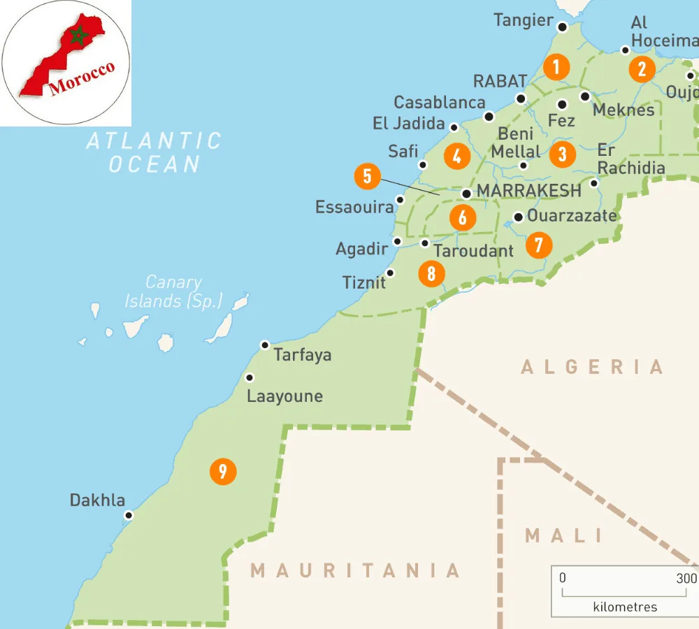
Best Map of Morocco With Cities
An Overview of the Kingdom of Morocco
Capital: Rabat
Region: Africa
Population: 35,739,580
Area: 446,550 square kilometers
Religion: Islam
Strategic Location
Bordering Countries: Algeria, Western Sahara, Spain (Ceuta and Melilla)
If we have a closer look at the map of Morocco with major cities bordering the famous historical countries, we already grasp the idea about the rich and deep historical background of this kingdom.
Table of Contents
Situated in the west of North African countries, the Kingdom of Morocco stands with its rich culture, profound customs, divine cuisine, and a blend of Arab, European, and African ethos. It is also popular with the name “Maghreb,” which means “Arab west” due to its geographical location. The kingdom is full of rugged landscapes and coastlines on the Mediterranean Sea and the Atlantic Ocean.
It is a Muslim country that has enjoyed independence for most of the time, unlike most of its neighboring countries, like Spain. It was once a part of the Roman Empire and was ruled by several kingdoms until the Arab conquests took place back in the seventh century. That was the time when Morocco gained independence from France in 1956. Morocco is now a part of the League of Arab States and enjoys the position of a member state. The capital of Morocco is Rabat; however, the largest city and the center of tourist attractions is Casablanca.
The Rich History of the Kingdom of Morocco
The geographical location of Morocco with the Atlantic Ocean and the Mediterranean Sea has contributed a lot in shaping its rich history. They were the Phoenicians, the first nation, who took control of the kingdom of Morocco, followed by the famous Romans, Vandals, Greeks, and the Visigoths. It was later in the 7th century B.C.E. when the Arabs invaded the area and brought Islam with them. Since then, Islam has been the state religion of the Kingdom of Morocco.
After its independence, Morocco took charge of a few Spanish-controlled regions. During the period 1969 and 1970, the Kingdom of Morocco expanded and took complete charge of the Spanish enclave. However, there are two parts of Morocco known as Ceuta and Melilla, which are still under the control of Spain.
The Government of Morocco
At present, the Kingdom of Morocco has bicameral legislation. The government is based on a constitutional monarchy. The position of king is now taken by the chief of state and the prime minister as the head of government.
Overall, the kingdom is divided into 15 regions with a legal system based entirely on the principles of Islam.
The Industrial Sector & Land of Morocco
The industrial sector of Morocco had gone through several changes before it finally reached a stable economic growth. However, the kingdom is still striving to grow its industrial sector. The major industries of Morocco include the food processing industry, textile industry, mining and processing industry, leather industry, and the fastest-growing of all, the tourism industry.
Moreover, one of the primary economic sectors of Morocco is the agriculture sector, where the main stock revolves around wheat, olives, citrus, and barley. Overall, the kingdom of Morocco has a prosperous economic area which enjoys tons of natural bounties.

The Boundaries & Neighboring Countries of Morocco
If you see the map of Morocco with cities and coastlines on it, you will be amazed by its geographical location. Located in North Africa, this country runs along the Atlantic Ocean and the Mediterranean Sea.
Morocco shares its borders with Algeria and Mauritania. Moreover, the country still has a border with Ceuta and Melilla, the enclaves which are still part of Spain. Morocco enjoys a variety of topography since it consists of various types of landscapes. The interior region of Morocco is mountainous just like its northern coast; however, due to the presence of coastline, it also contains fertile plains, due to which it has a fast-growing and productive agriculture sector.
Further Reading: How to Plan a Day Trip from Spain to Tangier?
Passing through various landscapes, rugged and rocky areas, and sloppy mountainous areas comes the peak of Morocco known as “Jebel Toubkal”, which is the highest point in this kingdom. “Jebel Toubkal” rises to a height of 4167 meters. On the other hand, “SebkhaTah” is as low as -55 meters below sea level and thus makes itself the lowest point in Morocco.

Famous Cities of Morocco
Morocco is the hub of tourism, and it enjoys an influx of tourists from all over the world. If you see the map of Morocco with major cities, you will find that the kingdom is full of historical places and distinct cities.
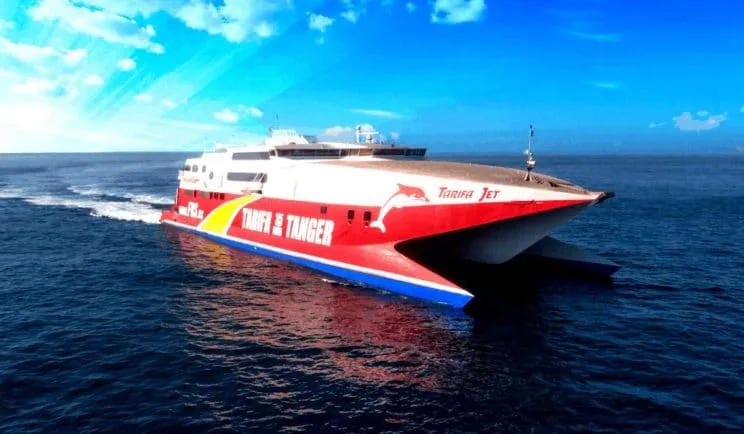
Further Reading: How To Get to Tangier From Tarifa By Ferry?
Although shrinking Morocco’s plethora of astonishing places is a daunting task to do but here are the famous tourist spots in Morocco, which are filled with tourists throughout the year.
Rabat
Rabat is the capital of Morocco. It is known as a city with the most welcoming culture and full of fun. The citizens of Rabat are open-minded people, and if you think of it as an average, dull city, then that’s wrong! There are places with delicious food, and there are gardens and several historical sites in Rabat.
You will find this city always buzzing with life and vibrant colors all around. However, due to its location, which is far away from the famous tourist spots like Marrakesh and Fez, this capital city doesn’t get much attention and love like Casablanca.

Casablanca
Casablanca is a center of attention not only the tourists from around the world but also a significant spot in Hollywood as well. Many movies are filmed in a beautiful city, which is even more substantial than its capital, Rabat. It won’t be wrong if we call it the “New York” of Morocco!
Among many eye-catching buildings and astonishing pieces of architecture, the city holds the seventh-tallest minaret of the Hassan 2 Mosque in the world.

Tangier
Tangier is known as the doorway to Africa. The city has a rich culture and history, and it was the wealthiest and attractive city back in the 1950showever, at present, it has lost some of its charms. The famous places to visit in this city are the Kasbah Museum, Ville Nouvelle, and some areas of detached Spain like the Strait of Gibraltar. Moreover, there are several beautiful beaches in the heart of Tangier. Read more about the 12 best things to do in Tangier, Morocco.

Marrakesh
Marrakesh lies in the foothills of the Atlas Mountains. The city is full of life, fun, and enjoys the mesmerizing nightlife. This city is full of history, and there are several ancient buildings and structures throughout the city, with the famous ones being the El Badi Palace and Saadian Tombs. The city is also renowned for its spices and jewelry.

About Us
Welcome to Tangier Excursions LLC, your gateway to unforgettable private day trips from Spain to Morocco! Specializing in seamless, culturally rich journeys across the Strait of Gibraltar, we craft personalized excursions that let you experience the magic of Morocco in just one day. Whether you’re departing from vibrant Spanish hubs like Tarifa, Seville, Malaga, Marbella, Cadiz, or Gibraltar, our curated adventures blend convenience, authenticity, and expert local insight to transform your travel dreams into reality.
Frequently Asked Questions
-
What are the major cities in Morocco?
The major cities in Morocco include Casablanca, Marrakech, Fes, Rabat (the capital), Tangier, Agadir, Meknes, Ouarzazate, and Chefchaouen. Each city offers a unique culture, history, and architecture.
-
Which city is the capital of Morocco?
Rabat is the capital city of Morocco. It is located along the Atlantic Ocean and is known for its historical sites, government institutions, and relaxed coastal vibe.
-
Where is Marrakech located on the map of Morocco?
Marrakech is located in central Morocco, just north of the Atlas Mountains. It’s a popular tourist destination famous for its medina, souks, and vibrant culture.
-
Is Tangier in northern Morocco?
Yes, Tangier is located in the far north of Morocco, on the Strait of Gibraltar. It’s one of the closest Moroccan cities to Spain and a gateway for many travelers arriving by ferry.
-
What is the largest city in Morocco?
Casablanca is the largest city in Morocco by population. It’s the country’s economic hub and home to the impressive Hassan II Mosque, one of the largest in the world.
-
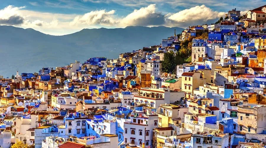
What are the blue cities of Morocco?
Chefchaouen is the most famous blue city in Morocco. Located in the Rif Mountains in the north, its buildings and streets are painted in shades of blue, making it a picturesque destination.
-
Which cities in Morocco are best for first-time visitors?
For first-time visitors, Marrakech, Fes, and Chefchaouen are top choices. Marrakech offers lively markets, Fes boasts a deep cultural heritage, and Chefchaouen provides a peaceful mountain experience.
-
Can I travel easily between Moroccan cities?
Yes, Morocco has a good network of trains, buses, and domestic flights connecting major cities. The train system, especially between Casablanca, Rabat, Fes, and Tangier, is fast and reliable.
-
What is the best city to start a Morocco tour?
Casablanca is often a common starting point due to its international airport. However, Marrakech and Tangier are also popular starting cities, depending on your entry point and travel interests.
-
How far is Chefchaouen from Tangier on the map?
Chefchaouen is about 115 km (71 miles) southeast of Tangier. The drive takes around 2–2.5 hours and offers scenic views of the Rif Mountains.